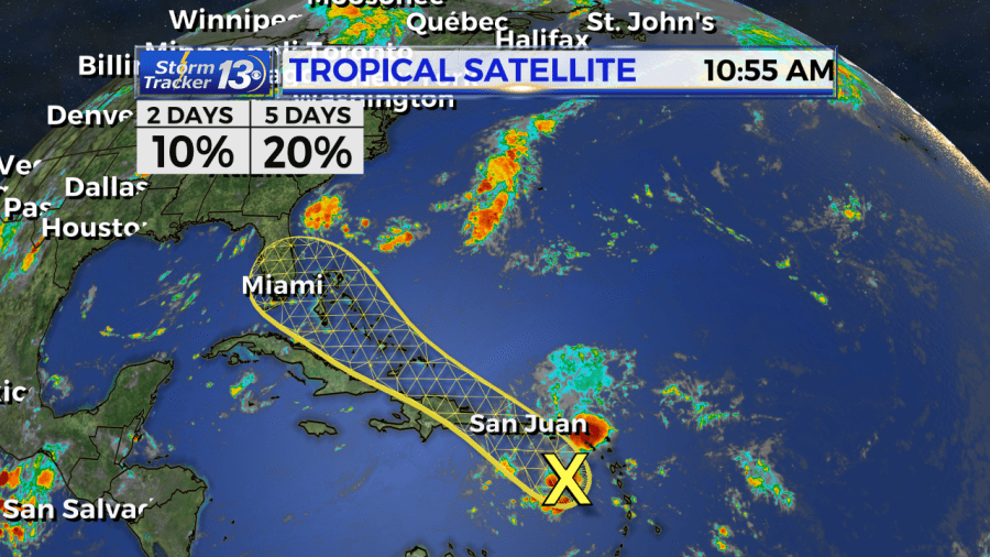
Shower activity associated with a tropical wave over the eastern
Caribbean sea is disorganized and limited. This system is expected
to move west-northwestward across the Caribbean sea and the greater
Antilles during the next few days bringing locally heavy rainfall
and possibly some flooding across portions of these islands.
As the system moves west, it will move through an environment with a lot of wind shear along with friction from the Islands. Tropical development is not expected in the next few day’s.

However, If the wave can survive, there is a small chance it could gain a little more strength as it nears Florida towards the end of the week.
Right now, most models keep this system below tropical storm statues. We’ll likely see increased showers and storms over Florida by Friday into the Weekend, This system will then move north closer to the Carolinas through the weekend, but staying just offshore as a very weak system. The combination of the front approaching from the west, and deep tropical moisture from the Atlantic will lead to increased shower and thunderstorm activity for the Grand Strand and Pee Dee late week into the weekend.


