5AM MONDAY UPDATE:
Tornado threat is down for the area and the tornado watch has been lifted. We saw over 8 to 10 inches of rain in the past 24 hours, this has added up on our already high rainfall totals. We’ll continue to see scattered showers and storms today, but not as widespread. We’ll also continue to watch the river levels rise above major flood levels. Roads are already flooded and closed.
SUNDAY EVENING UPDATE:
The threat for isolated tornadoes will continue to wind down overnight but a small chance remains to see one or two. Florence remains a depression and is pulling away from the Carolinas at 14 mph to the north. The National Hurricane Center is no longer issuing advisories on the remnants as it will continue to be sheared apart.
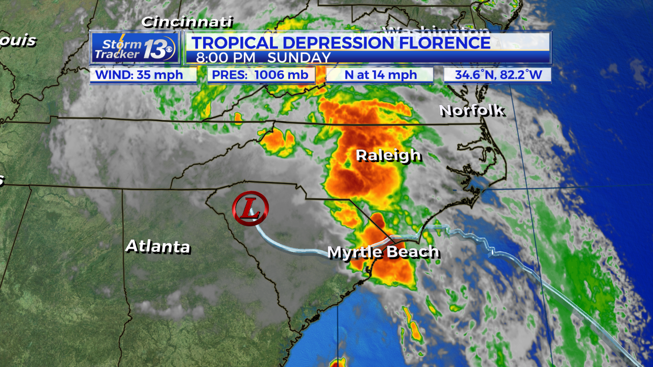
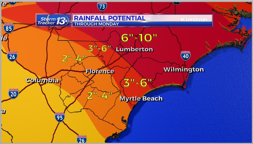
Torrential rains will gradually taper off overnight but an additional 2 to 4 more inches of rain could fall area-wide through Tuesday with isolated amounts up to 8 inches. Any lingering streams of moisture will not be as intense or consistent Monday or Tuesday but scattered smaller showers and storms are possible.

A cold front will sweep the area on Tuesday night and behind it, much drier air will filter in. Temps will remain warm but the humidity levels will be considerably lower for the end of the week. This will give some areas a chance to dry out somewhat.
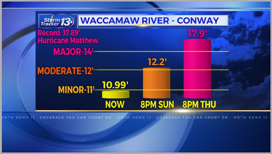
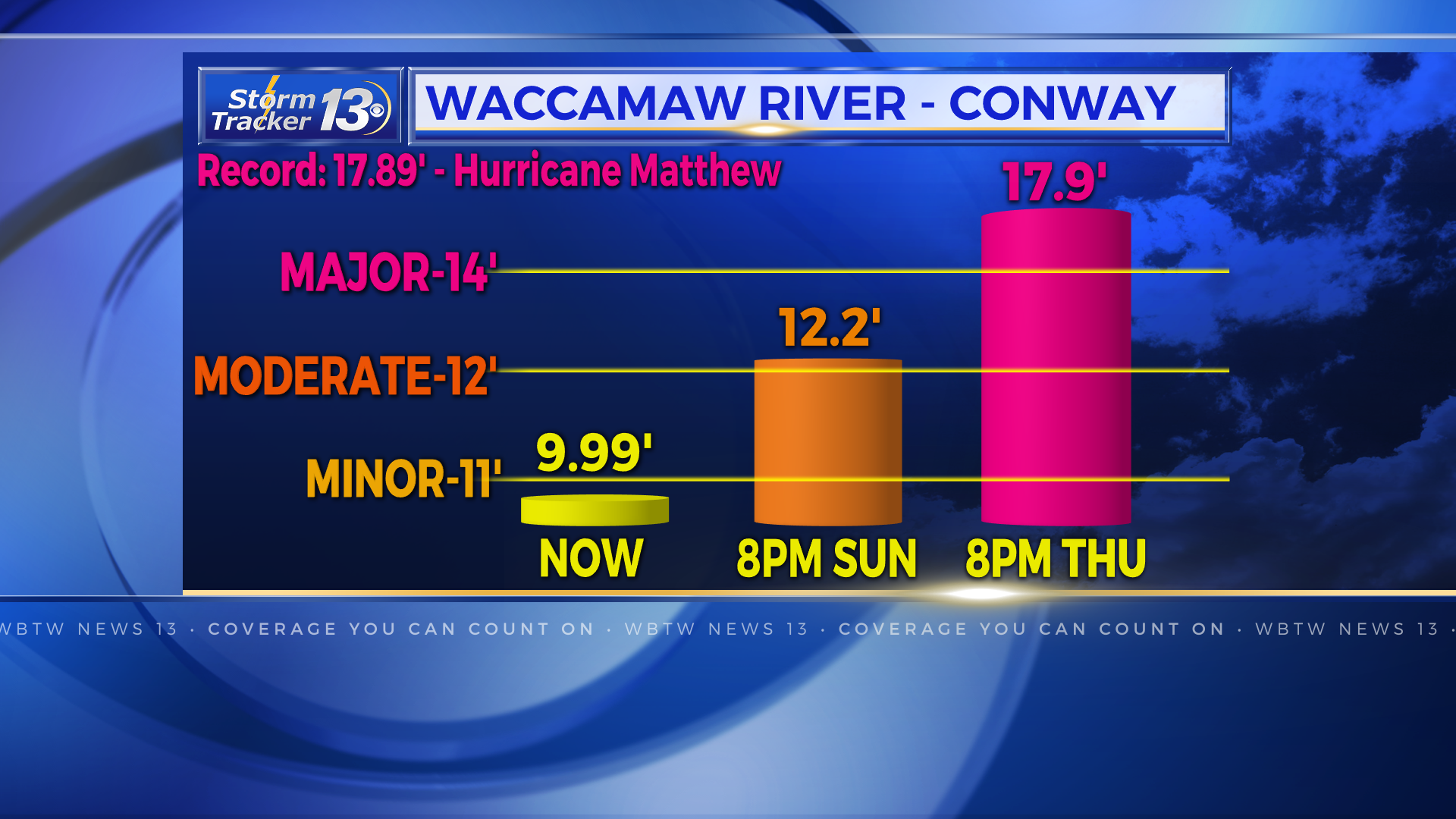
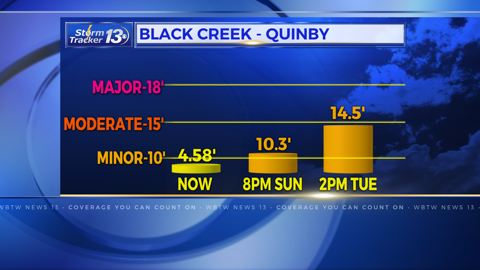
Rivers are still forecast to crest this week. The Waccamaw River at Conway is above the moderate flood stage and isn’t expected to crest until Friday morning at 17ft. The Black Creek in Quinby is at minor flood stage and is expected to crest at 17.2 ft by Tuesday. The Pee Dee River in Cheraw is on it’s way to cresting near record levels of 49 ft by Tuesday.
9AM SUNDAY UPDATE:
Tropical Depression Florence continues to weaken as it slowly moves away but it will still bring flooding rain to the Carolinas.
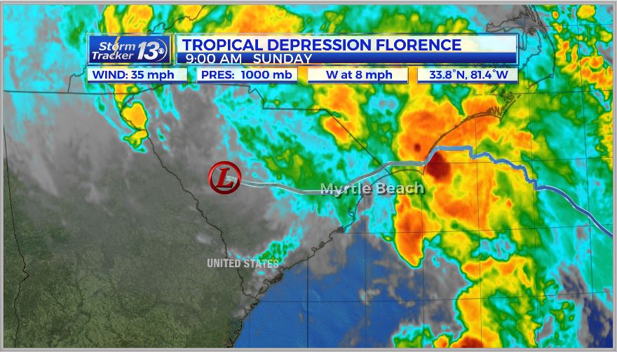
Heavy rain band will continue to move across the area for much of the day today and into Monday.
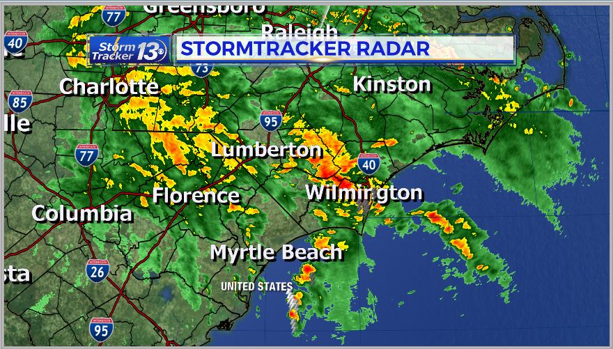
A Flash Flood Watch is in effect for much of the area through today.
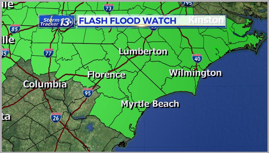
Expect off-and-on heavy rain for much of the day today, tonight and into Monday morning. Rain on Monday will be a little more broken up but some heavy pockets of rain is still possible.
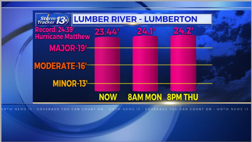
River levels will continue to rise as the heavy rain continues. Many rivers are expected to crest above major flood stage, some like the Lumber River in Lumberton and the Waccamaw River in Conway could meet or exceed levels set from Hurricane Matthew.
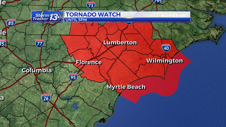
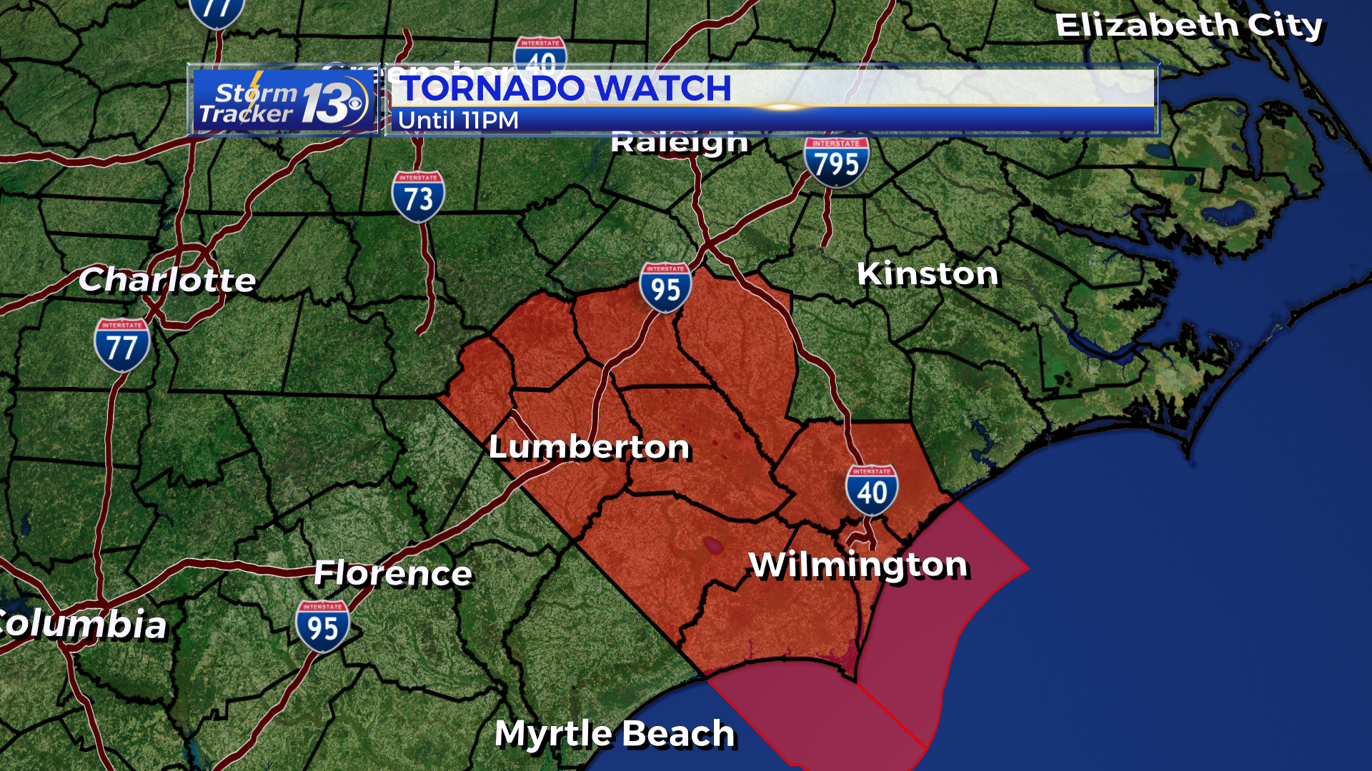
In addition to the flooding this week, A Tornado Watch has been issued for Horry, Columbus, Robeson, Scotland, Dillon, Marion, Florence, Darlington and Marlboro counties until 5pm Sunday.
__________________________________________________________________________________
5AM SUNDAY UPDATE:
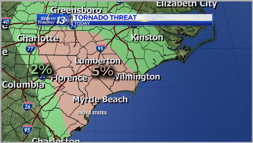
Florence has now weakened into a tropical depression, but the area will still see heavy rain through the rest of the day. There is also a chance for an isolated tornado or two. Most of our area is now in the “slight” risk for severe weather, with the threat being a 5% chance for a tornado.
We could see an addition 2-5 inches of rain with pockets of higher amounts around the Border Belt.
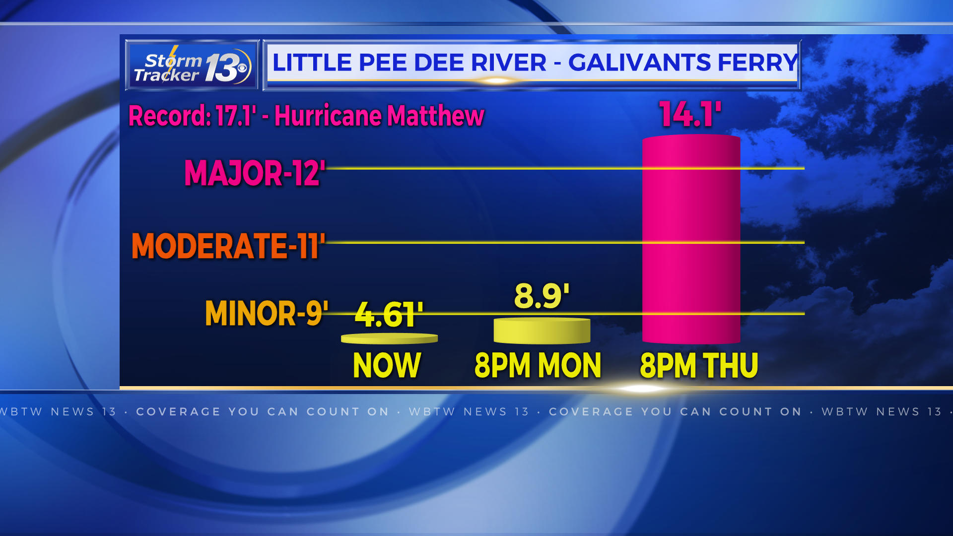
The heavy rain will continue across parts of the Piedmont of NC, with the rain that we have seen, along with the water that will flow downstream, our rivers will be at risk for flooding at historical levels.
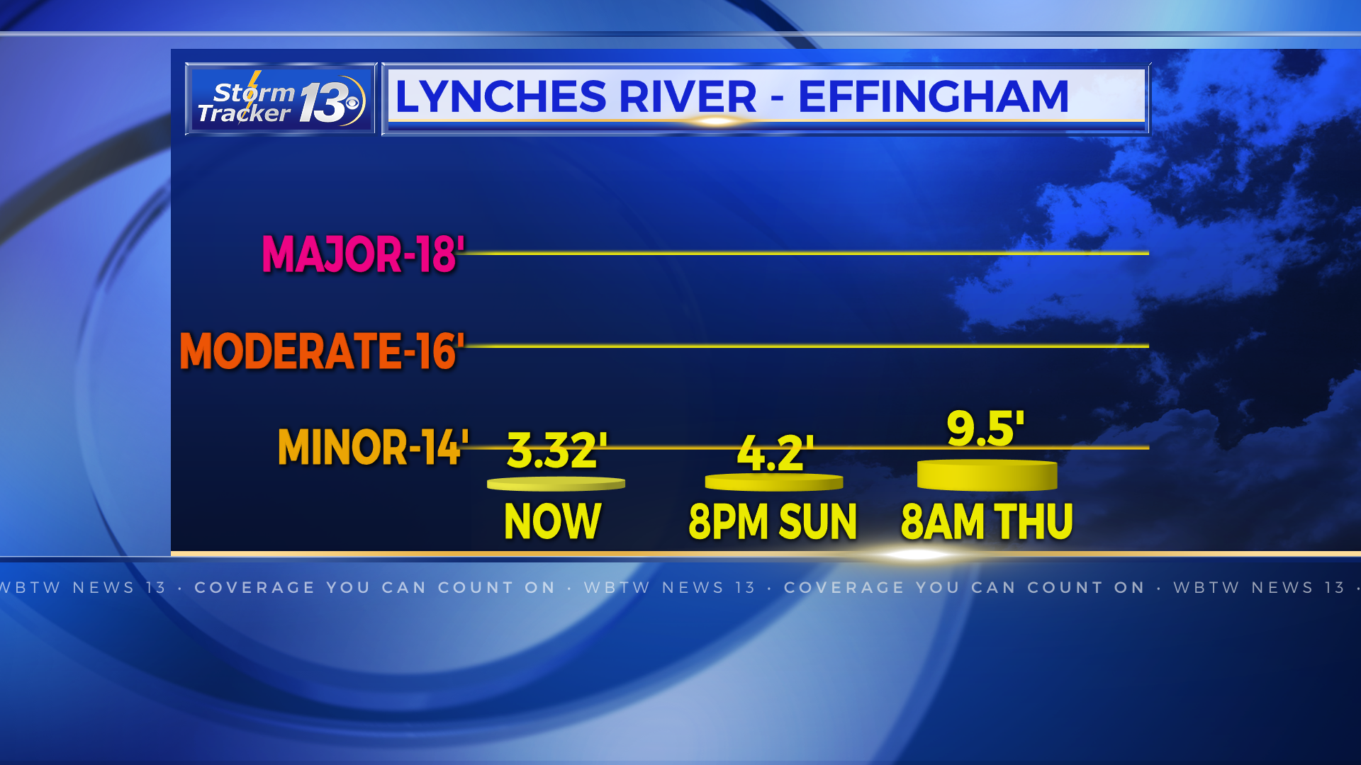
The forecasts are displayed below.


11:30 PM UPDATE:
Florence remains a Tropical Storm with sustained winds of 40 mph, most of which are being felt up in Wilmington. The biggest threat remains the potential for flooding especially along area river. The latest forecast has come out and we’re looking at river levels similar to that of Hurricane Matthew just two years ago.
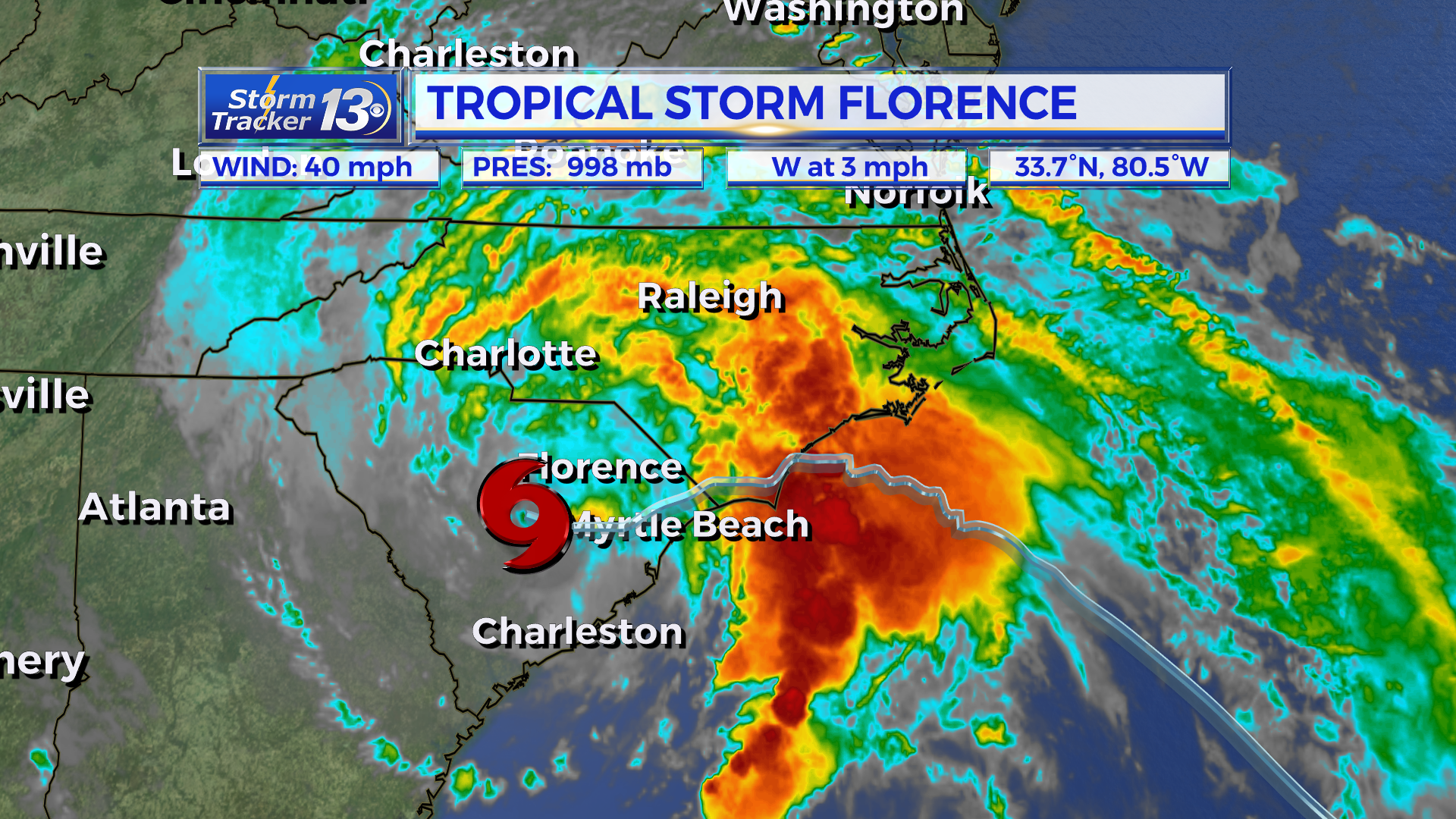
The forecasts are displayed below.


10:30 PM UPDATE:
NC Highway Patrol one hour ago said that the sandbagging effort at the railroad track area under I-95 where water can pass through had not breached.
Emily Jones with Robeson County says water rescues have begun in south Lumberton.
With the downpour of rain continuing, the SEATS transportation service that was helping people get to shelters has been suspended. So has EMS service in Lumberton until conditions improve.
Again, a mandatory evacuation for south Lumberton – anything along and off of MLK Blvd.
8:30 PM UPDATE:
Heavy rain continues through Brunswick, Columbus, Robeson and Scotland Counties. 10-18 inches of rain have been reported in this area, and flooding is ongoing. People living in low lying areas of Robeson County are urged to evacuate. Shelters are open at St. Pauls High School, Purnell Swett High School, Lumberton High School, and Fairmont Middle School. A mandatory evacuation has been declared for South Lumberton. The Lumber River has reached flood stage and will be in major flood stage tonight, with a levels higher than those experienced during Hurricane Matthew.
5:30 PM UPDATE:
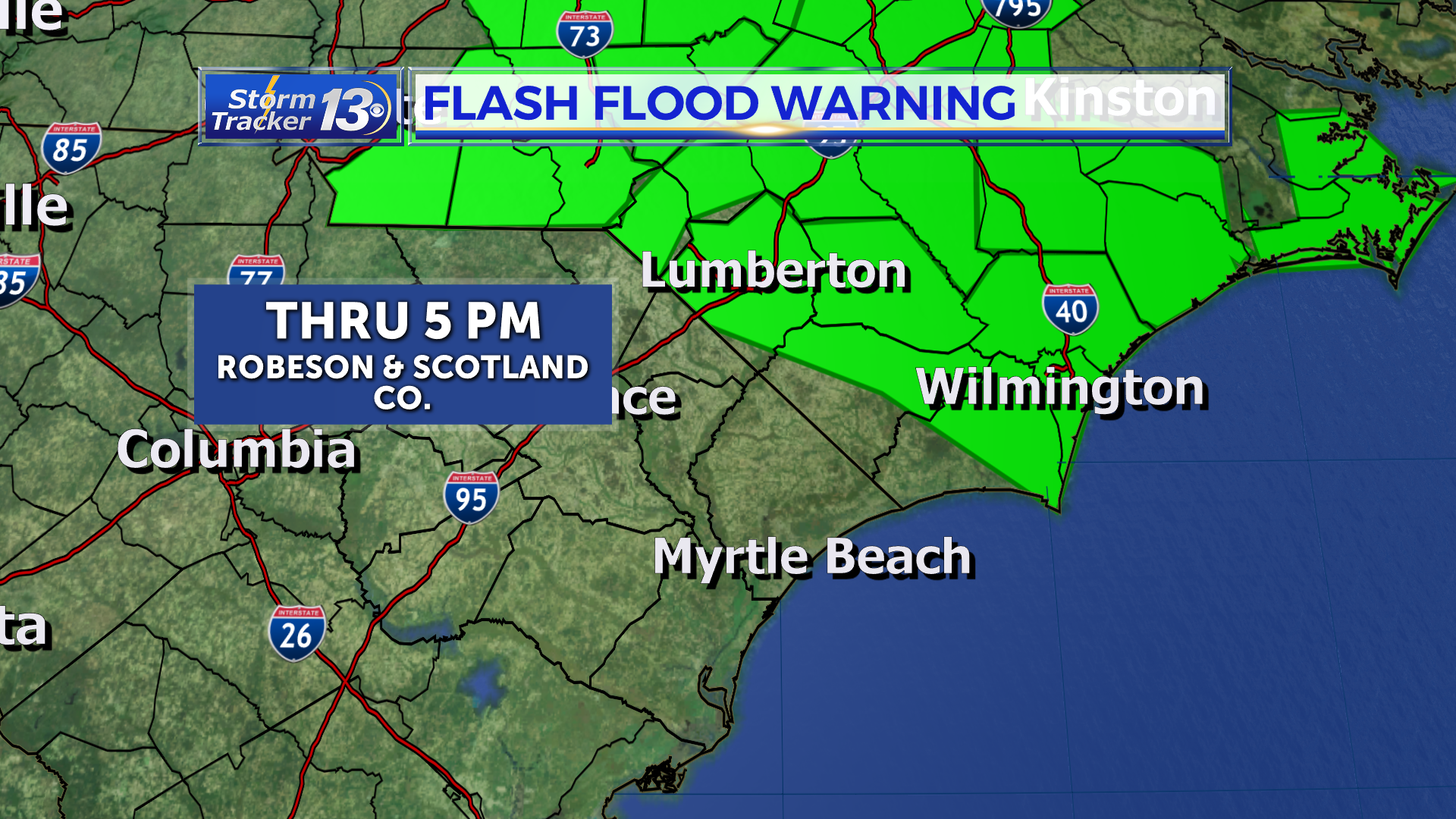
The Flash Flood Warning has been extend through 10:00 pm tonight for Scotland and Robeson Co. Up to 15 more inches of rain are possible through tomorrow with the steady band of very heavy rain fall moving through. Rain is accumulating at up to two inches per hour in the heaviest of rain.
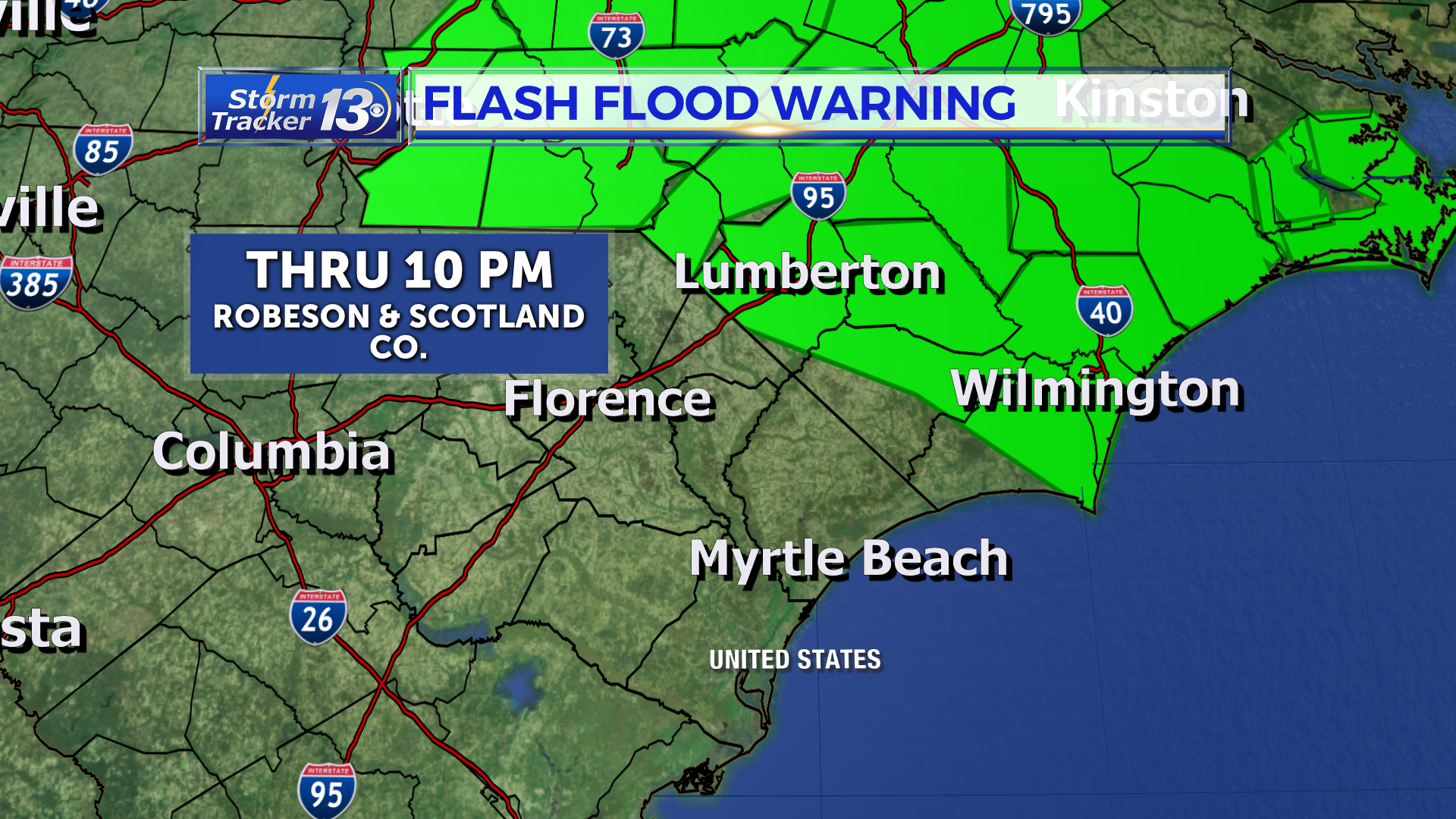
The Tornado Watch has been extended in to Scotland Co as well and now goes through 11 pm tonight. There is a low to chance to see an isolated, quick spin up of a tornado or two within the stronger band of heavy rain moving through.
Tha Flash Flood Watch remains in effect for all of eastern Carolina. River Flood Warnings remain in effect for all rivers as well. A more indepth explanation of those can be found here: https://digital-stage.wbtw.com/weather/stormtracker13-hurricane-center/rivers-to-reach-major-flood-level-with-florence-rain/1447714820
4:00 PM Road Reports:
Robeson Co:
Singletary Church Road at NC-41 near Lumberton is impassable and closed in both directions due to flooding.
Barker Ten Mile Road Near Vester Road is impassable due to flooding
Howell Rd near Redan Church Rd is impassible in both directions due to flooding.
Pine Log Rd and NC-711 and NC-72 near Lumberton is impassible.
NC-72 impassible in both directions due to flooding near Philadelphus Rd.
NC-72 is closed in both directions near Lewis McNeill Rd in Red Springs, NC. Road is impassible.
Davis Rd near US-301 impassible due to flooding near McDonald, Nc.
4:00 PM UPDATE
A Flash Flood Watch remains in effect for all of the eastern Carolinas for the additional rainfall expected. Flash Flood Warnings remain in effect for Scotland and Robeson Co as waters will rise quickly and unexpectedly.
3:30 PM Saturday:
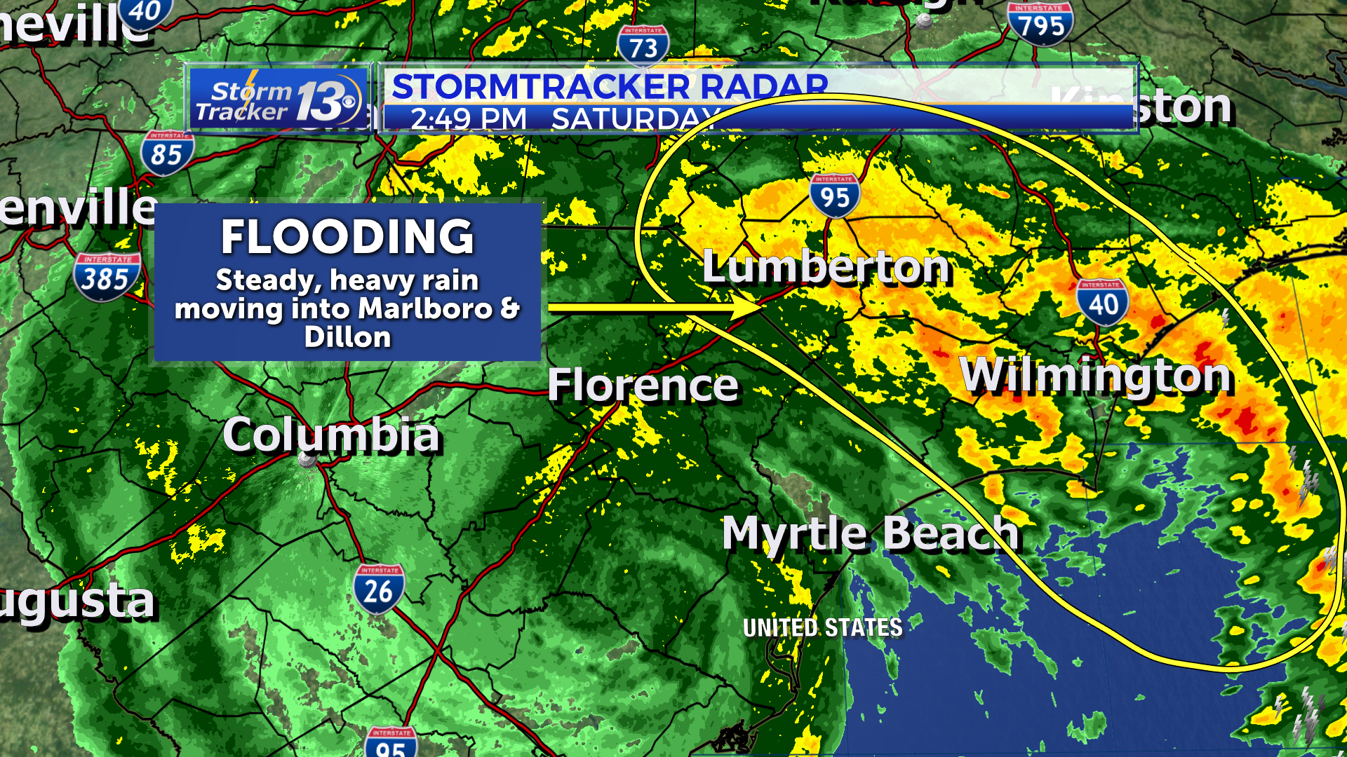
Flooding is now the primary concern across the eastern Carolinas, although there will still be gusty winds in the stronger rain bands that come through. Moderate rain will continue to fall in Scotland and Robeson Co. This heavier band will drift in Marlboro and Dillon Co early this evening.
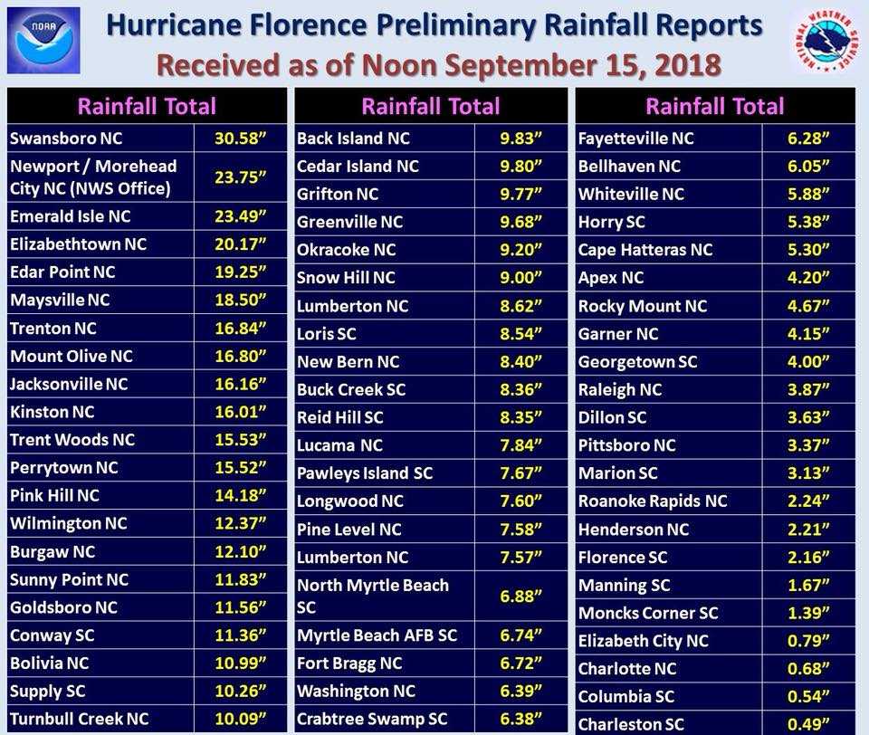
Accumulated rainfall totals as of noon are displayed below for our region. Robeson Co could see up to 14 inches more through the beginning of the week. Marlboro, Marion, Dillon, and Horry county could see up to 7 to 10 more inches of rain. Chesterfield, Darlington and Florence county could see an additional 5 to 7 inches. Georgetown and Williamsburg could see 3 to 5 more inches.
