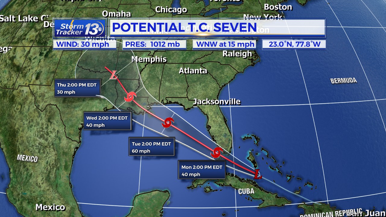
Tropical Outlook: There are two systems in the Atlantic we that currently have our attention. The first is a developing tropical wave near north of Cuba. This activity is forecast to move northwest over Florida into the Gulf of Mexico over the next 5 days. A tropical depression is likely to form overnight and further strengthening into Tropical Storm Gordon is likely on Monday. This storm will bring heavy rains and gusty winds to portions of Florida and the Gulf Coast States. However, it will not affect us in the Carolinas.

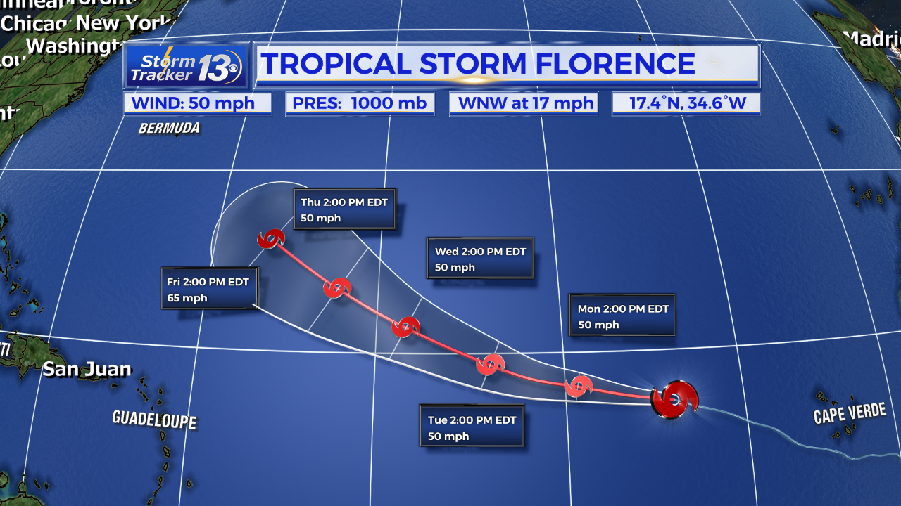
Way out in the Eastern Atlantic is Tropical Storm Florence. Florence has winds of 50 mph and is moving WNW. The official forecast keeps Florence on a west to northwest track over the next 48 hours and then turns ever so slightly more northward by the middle of next week. Some models keep Florence moving west for a little longer but overall, Florence should eventually turn north before it approaches the US. We’ll be watching this over the next 5 days as well.

Behind Florence, forecast models suggest two more tropical waves could come off the West African coast and also move west. Something we will continue to keep a close eye on as we are nearing peak of hurricane season.


