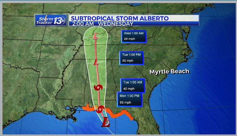
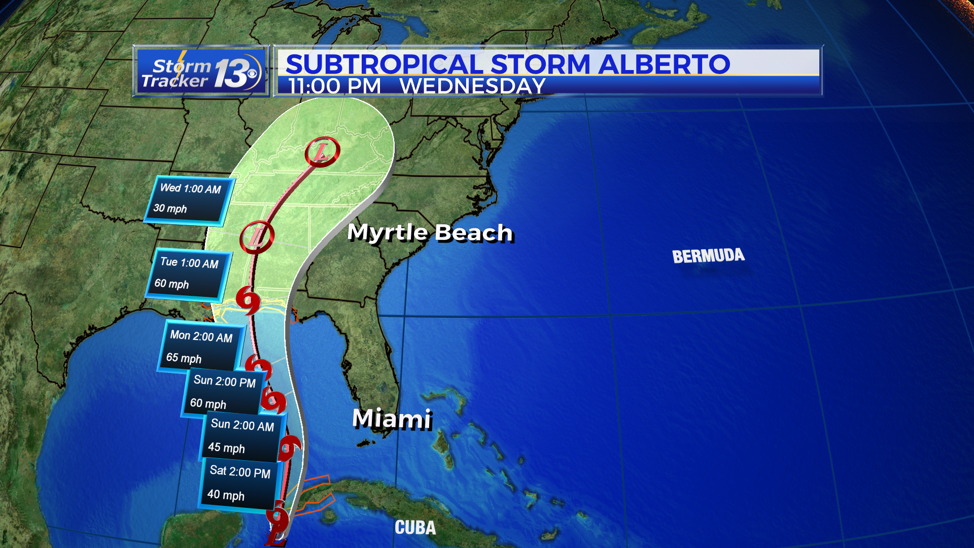
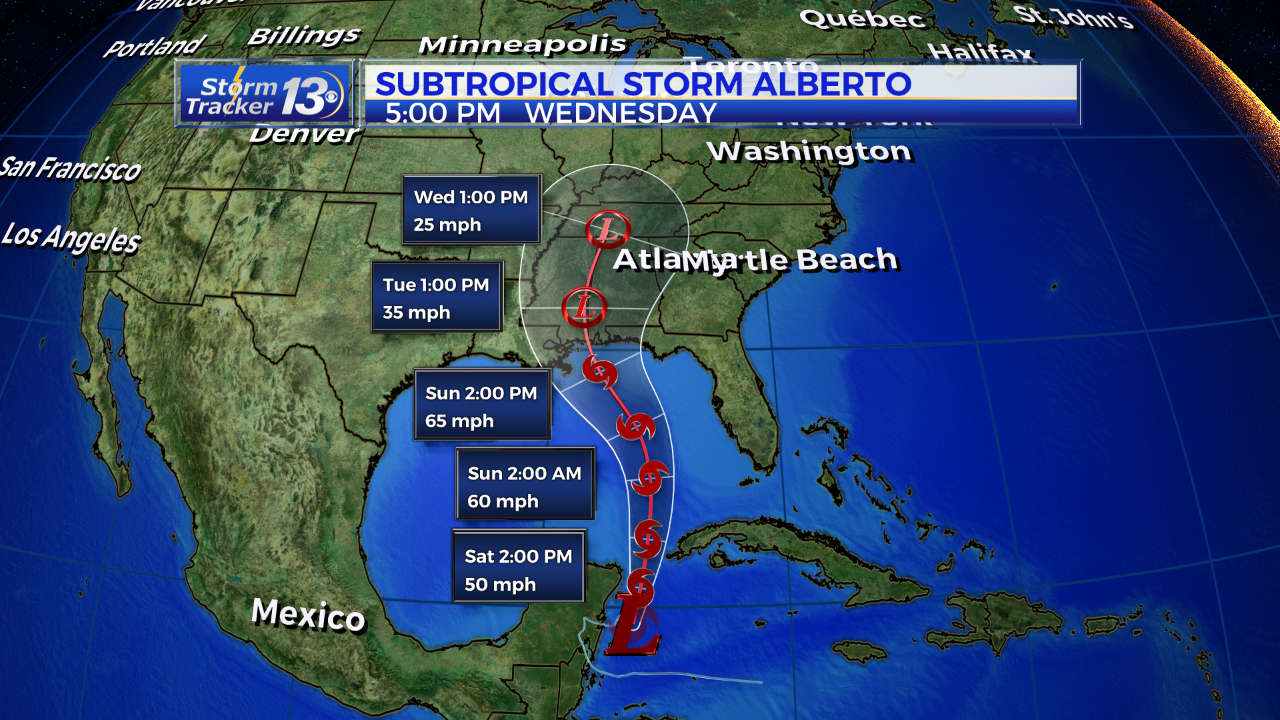
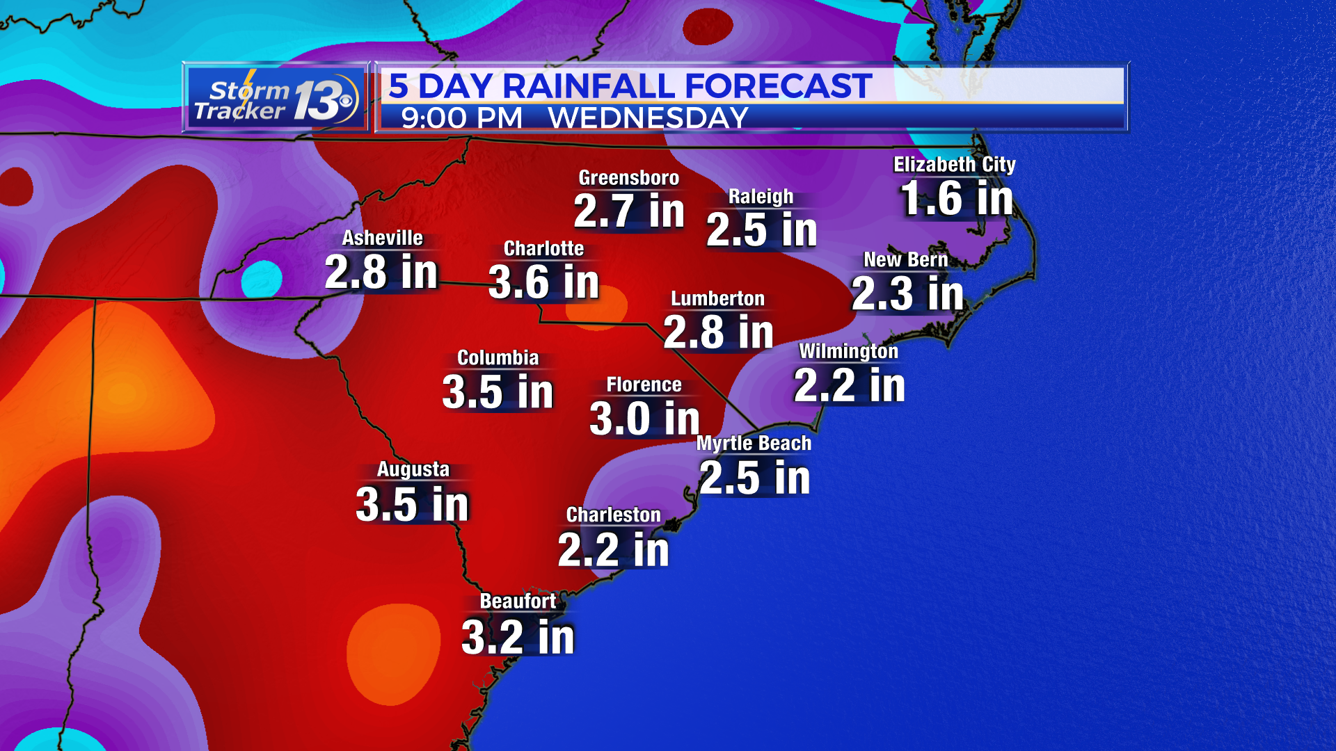
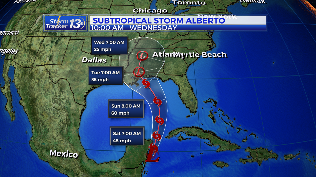
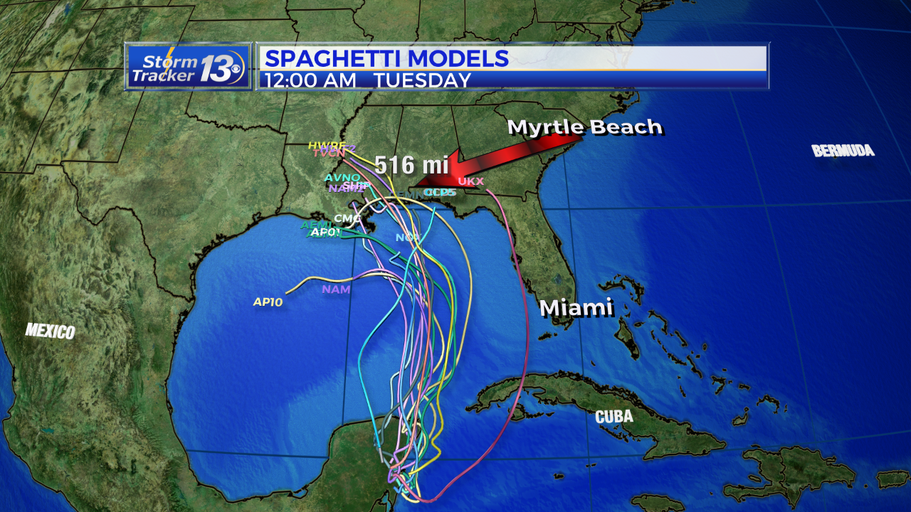
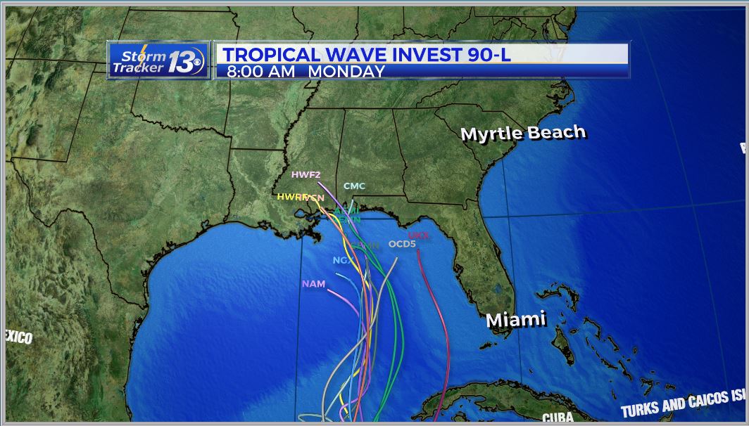
Monday, May 28th 8:00 am Update
Subtropical Storm Alberto is moving north at 6 mph this morning with max sustained winds of 65 mph. The center of the storm is about 50 miles from Panama City and about 80 miles from Destin. The structure of the storm remains asymmetrical with most of the rain on the north and east side. As Alberto moves further north, it has slowed down a bit and is not expected to strengthen any further. It’s expected to make landfall sometime this afternoon just to the east of Pensacola, Fl

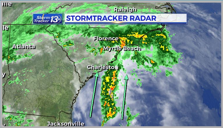
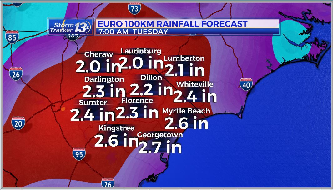
Expect the heaviest rain across the Carolinas over the next 24 hours as the system moves inland.
A steady stream of moisture is moving in from the south and will continue throughout much of the day.
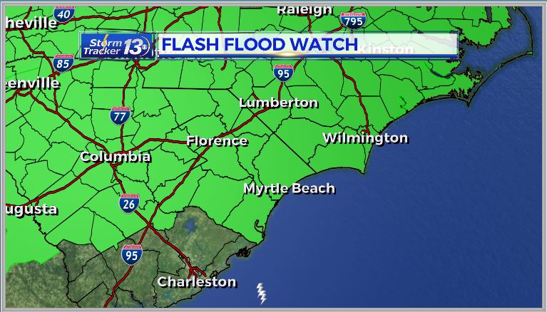
A Flash Flood Watch is in effect for the entire area until 7am on Tuesday, 5/29
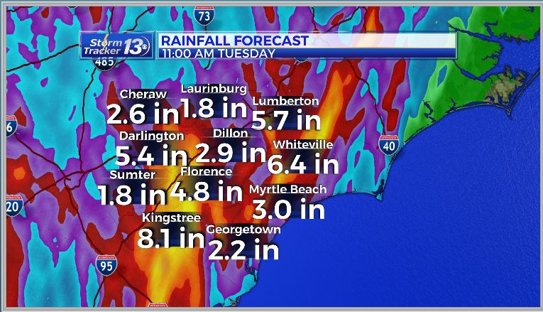
Forecast models are suggesting 3″ to 5″ of rain over the next few days, with the heaviest rain occurring today, Some spots could pick up a little more depending on where the line of storms sets up and continues to dump rain on some of the same areas.
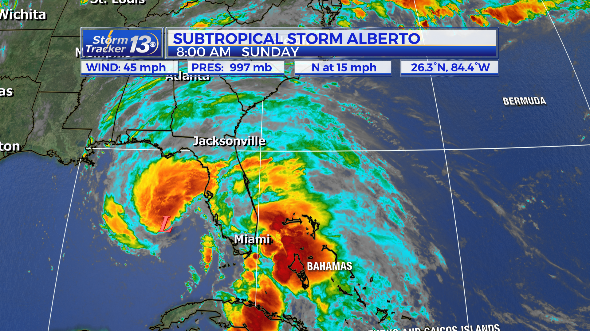
Sunday, May 27th 8:00 AM Update
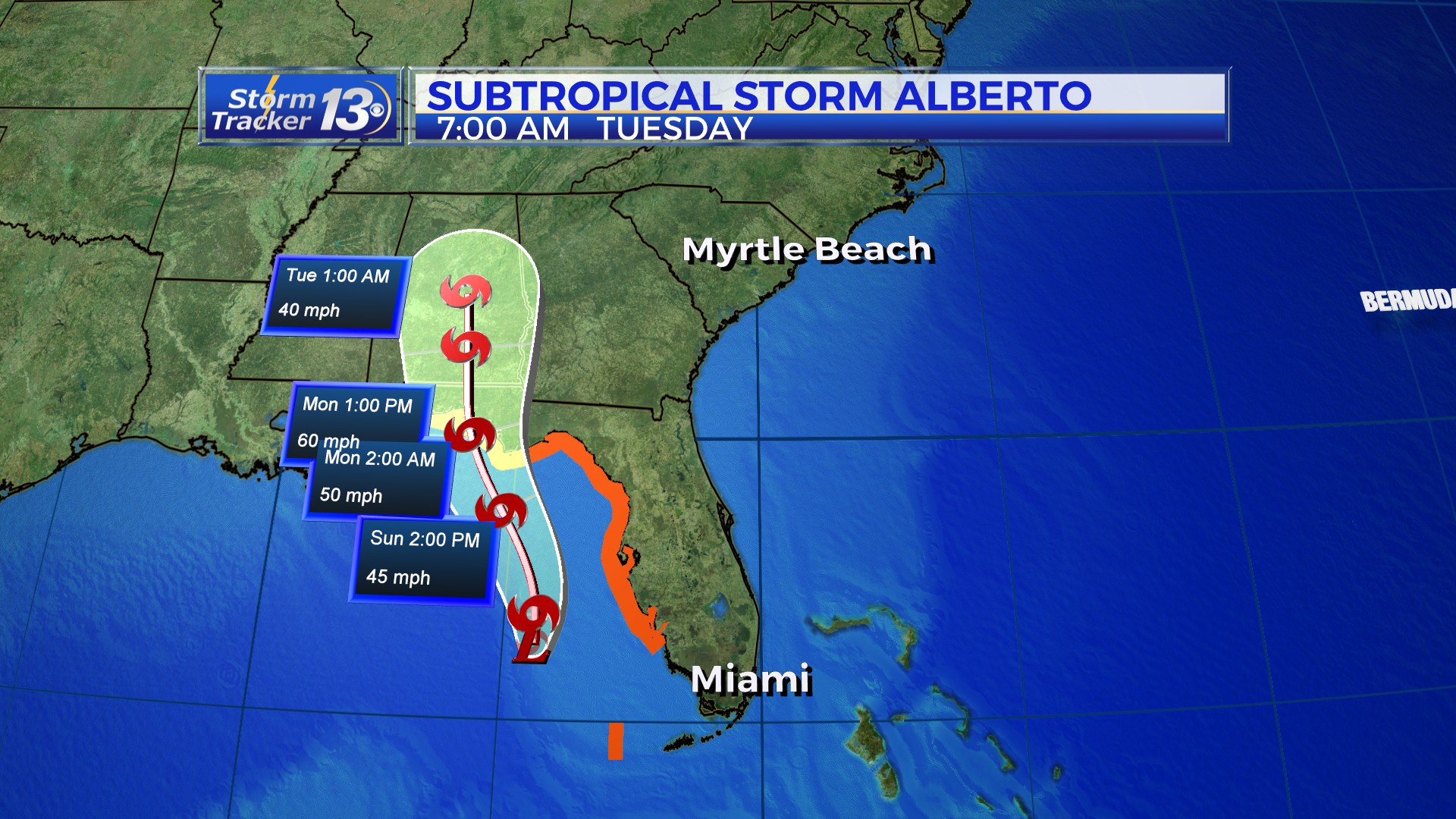
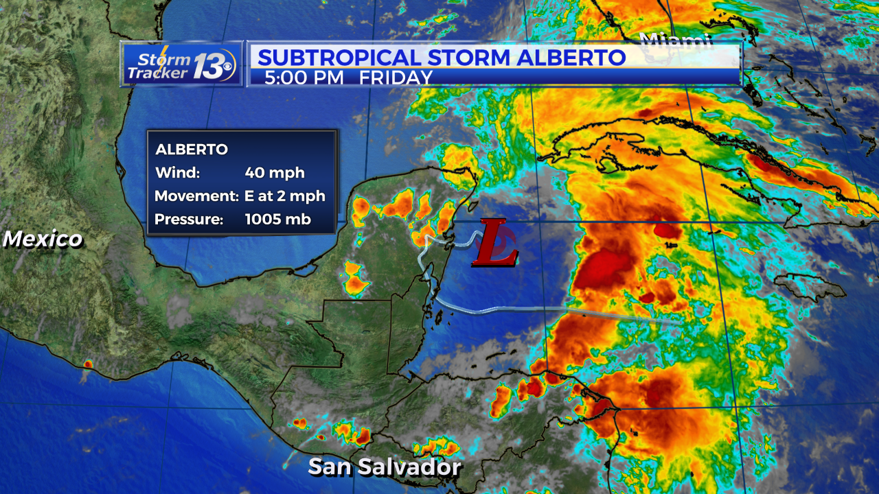
Subtropical Storm Alberto is moving north at 15 mph this morning into the Gulf of Mexico with winds of 40 mph. The center of the storm is about 300 miles WNW of Miami. The structure of the storm remains asymmetrical with most of the rain on the north and east side. However, the storm is starting to get a little bit more organized with more thunderstorm activity near the center. As Alberto moves further north, it is expected to slow down and strengthen, eventually making landfall sometime Monday midday in the northern Gulf.
In the Carolinas: the main threat continues to be the potential for flooding Monday through Wednesday where an additional 3 to 6 inches of rainfall is expected on top of an already saturated ground. Long periods of widespread showers, and potentially very heavy rainfall, is likely beginning early Monday morning. Rainfall totals will likely be highly variable but on average at least 3 inches of rainfall is possible and higher totals will accumulate on the coast.
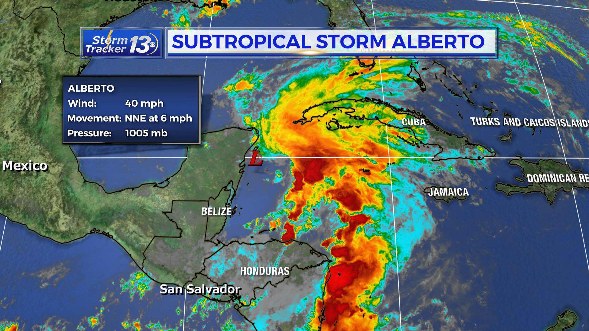
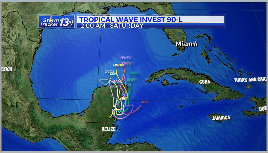
Saturday, May 26th 8:00 PM Update
Subtropical Storm Alberto is moving north at 13 mph this evening into the Gulf of Mexico with winds of 40 mph. The center of the storm is about 300 miles WSW of Miami. The structure of the storm remains asymmetrical with most of the rain on the north and east side. This is typical of subtropical storms but the upper level winds remain strong as well. As Alberto moves further north, it is expected to slow down and strengthen, eventually making landfall sometime Monday midday in the northern Gulf.
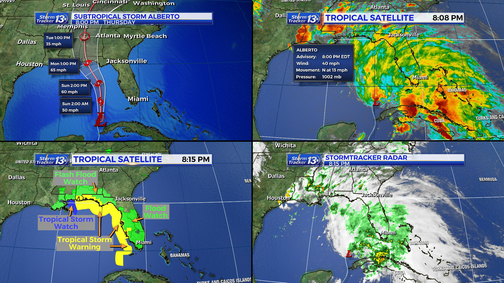
Tropical Storm Warnings have now been issued for the entire west coast of Florida while Flood Watches and Warnings have been issued for inland counties. A tornado threat exists in Florida’s peninsula tonight and in through the day on Sunday. These tornadoes will likely be very quick moving and form with potentially little to no warning.
In the Carolinas: the main threat continues to be the potential for flooding Monday through Wednesday where an additional 3 to 6 inches of rainfall is expected on top of an already saturated ground. Long periods of widespread showers, and potentially very heavy rainfall, is likely beginning early Monday morning. Rainfall totals will likely be highly variable but on average at least 3 inches of rainfall is possible and higher totals will accumulate on the coast.
Previous Updates:
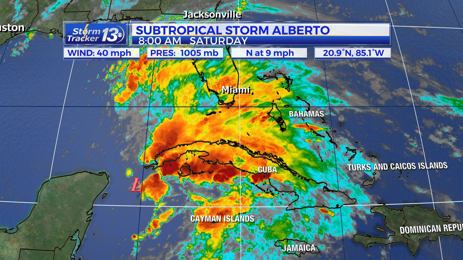
Saturday, May 26th 8:00 AM Update
Subtropical Storm Alberto now moving north-northeastward toward the Yucatan Channel. Alberto is still trying to get better organized but most of the thunderstorm activity is still well to the east of the center of circulation, do to a good amount of wind shear. The 8AM update from the NHC still has winds at 40 mph. Alberto is moving due north at 9mph. Tropical Storm and Storm Surge Watches have been issued for parts of the Gulf Coast. Alberto will begin to move north overnight and on Saturday into more favorable conditions for strengthening.
The forecast for the Carolinas has not changed with the exception of Sunday trending a little drier for the first half of the day. Even though we’ll be over 500 miles from the center of the storm, tropical moisture will continue to feed in our direction. A record amount of moisture is expected to stream in.
Long periods of rain, which will be heavy at times, will be likely starting Sunday night and lasting through the middle of next week. The biggest hazard we will face will be flooding due to an already saturated ground. It is difficult to pinpoint who will see the most rainfall over the coming days but a Flash Flood Watch may need to be issued for areas that see storms train over the same areas.
A moderate risk for rip currents will linger through the weekend, be mindful of your surroundings while at the beaches this weekend.
Friday, May 25th 5:00 PM Update
Subtropical Storm Alberto is still slowly trying to organize in the Caribbean Sea but it is nearly stationary. For now, conditions remain unfavorable for much strengthening due to strong upper level winds. Hurricane Hunters are in the storm as of 5 pm and are getting data from inside to try and find a defined center of circulation. The 5 PM update from the NHC still has winds at 40 mph. Tropical Storm and Storm Surge Watches have been issued for parts of the Gulf Coast. Alberto will begin to move north overnight and on Saturday into more favorable conditions for strengthening.
The forecast for the Carolinas has not changed with the exception of Sunday trending a little drier for the first half of the day. Even though we’ll be over 500 miles from the center of the storm, tropical moisture will continue to feed in our direction. A record amount of moisture is expected to stream in.
Long periods of rain, which will be heavy at times, will be likely starting Sunday night and lasting through the middle of next week. The biggest hazard we will face will be flooding due to an already saturated ground. It is difficult to pinpoint who will see the most rainfall over the coming days but a Flash Flood Watch may need to be issued for areas that see storms train over the same areas.
A moderate risk for rip currents will linger through the weekend, be mindful of your surroundings while at the beaches this weekend.
Previous Updates:
Friday, May 25th 12:00 PM Update
The National Hurricane Center has officially named the system we have been watching in the tropics. Subtropical Storm Alberto has winds of 40 mph and is slowly drifting north northeast. Alberto is expected to gradually move north into the Gulf of Mexico and strengthen slightly. Warmer waters in the Gulf and lower wind shear will aid in that strengthening but drier air could inhibit the intensification.
No direct impacts will be felt in South or North Carolina. Tropical moisture will spread into our region though and keep rain chances elevated started Sunday afternoon. The highest chances for showers and heavy rain will be Monday, Memorial Day. Minor flooding will be possible due to the ground being well saturated after our recent rains.
Between 2 and 4 more inches could fall across the eastern Carolinas.
Friday, May 25th 8:00 AM Update
Invest 90L continues to show slightly better organization near the Yucatan Peninsula. The chances of development have gone up to 90% in the next 48 hours and 90% in the next 5 days. Conditions will continue to favor development as it moves through the Gulf of Mexico.

It currently sits along the eastern coast of the Yucatan Peninsula with winds at 40 mph, slowly moving to the east at 5 mph. It is expected to make a turn to the north throughout the day and moving into the Gulf of Mexico by Saturday.
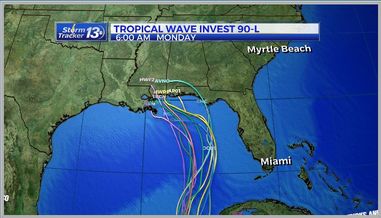
As it moves through the Gulf, the wind shear reduces, especially the closer it moves to the Gulf Coast. The formation of a tropical/subtropical depression is likely, while tropical storm Alberto is possible. Regardless of further development, our main impact is going to be the potential for heavy rain. The tropical moisture will start to move into our area late Sunday afternoon and evening. Expect periods heavy rain for Memorial Day and into Tuesday morning. Rainfall totals could top 2″-3″ through Tuesday.
Thursday, May 24th 5:00 PM Update
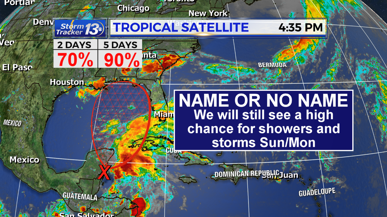
Invest 90L continues to show slightly better organization near the Yucatan Peninsula. The chances of development have gone up to 70% in the next 48 hours and 90% in the next 5 days. Conditions will continue to favor development as it moves into the Gulf of Mexico.
There is also better consensus between models Thursday that it will slowly continue to move north into the Gulf of Mexico over the weekend and into next week; Far away from the Carolinas.
For the Carolinas:
Regardless of development or not, we could see heavy rain going into Sunday, Monday and Tuesday. Several inches of rain are expected but the strength of the system will determine the amount of rain that falls.
A stronger storm would result in slightly drier conditions for us due to the storm being better organized and keeping moisture closer to the center. A weaker storm would allow tropical moisture to fan out over a larger area, essentially allowing a better chance for rain here.
As of Thursday evening, at worst, Invest 90L has the possibility to develop into a weak to moderate tropical or subtropical storm with winds up to 55 mph.
10 am update Thursday:

An area of low pressure on the SE coast of The Yucatan Peninsula has become a little better organized over the last 24 hours.
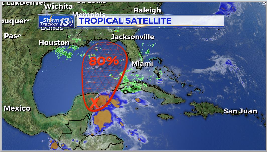
Not much development is expected over the next 48 hours but as it slowly moves to the NE into the Gulf of Mexico condition become more favorable. The National Hurricane Center is forecasting an 80& chance for further development into a tropical or subtropical depression this weekend.
As the system moves further to the north, conditions will become more favorable as wind shear reduces, especially the closer it gets to the Gulf Coast.
Sunday afternoon/evening and throughout the day on Monday is when we can see the most impact from this system as it moves closer to the Gulf Coast.
Our main impact, regardless of further development, will be the potential for heavy rain. Rain chances will increase throughout the day on Sunday and will last throughout the Memorial Day. We could see periods of heavy rain, especially on Monday.


