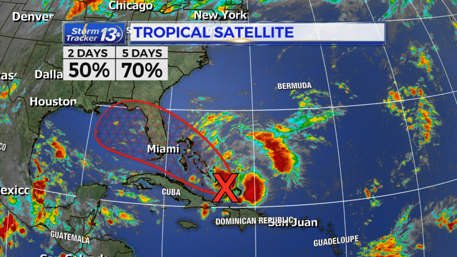
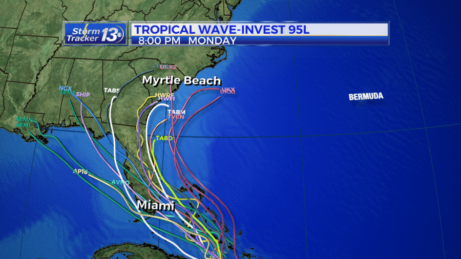
5AM THURSDAY SEPT 12TH UPDATE: We are currently monitoring three tropical waves that could develop into something more tropical. The first is a wave with shower and thunderstorm activity near Turks and Caicos. The activity here has increased over the past several days. Limited development of this disturbance is expected during the next couple of days as it moves west-northwest. However, environmental conditions could become more conducive for development when the system moves over the Florida Straits and the Gulf of Mexico later this week into the weekend. There is now a 70% chance for tropical development in the next 5 days. Models were hinting at the possibility of this moving over Florida and into the Gulf of Mexico, however, latest forecast models are have been shifting a little more east. We’ll continue to monitor the latest over the next several days.
The second tropical wave is invest area 94L located about 300 miles east of the Lesser Antilles. This weak area of low pressure is producing disorganized showers and storms. Some slight development is possible, however upper-level winds are forecast to become unfavorable for any tropical cyclone formation. This area has a 10% for tropical development.
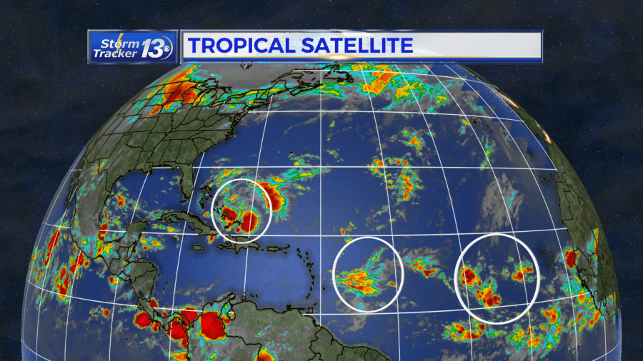
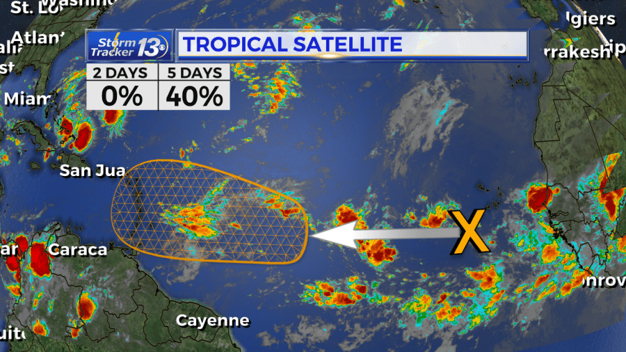
Behind invest area 94L, is a tropical wave coming off the West African coast. This wave is expected to move quickly westward during the next several days. It is possible it could merge with the other tropical wave and have a better chance for tropical development through the next several days into next week. Models are picking up on this one a little more. Right now the National Hurricane Center is giving this a 40% chance for tropical development over the next 5 days as it approaches the Lesser Antilles. At this time, there is no threat the Carolinas or the U.S. with this storm, but it is one we will continue to monitor.
5PM WEDNESDAY SEPT 11TH UPDATE:
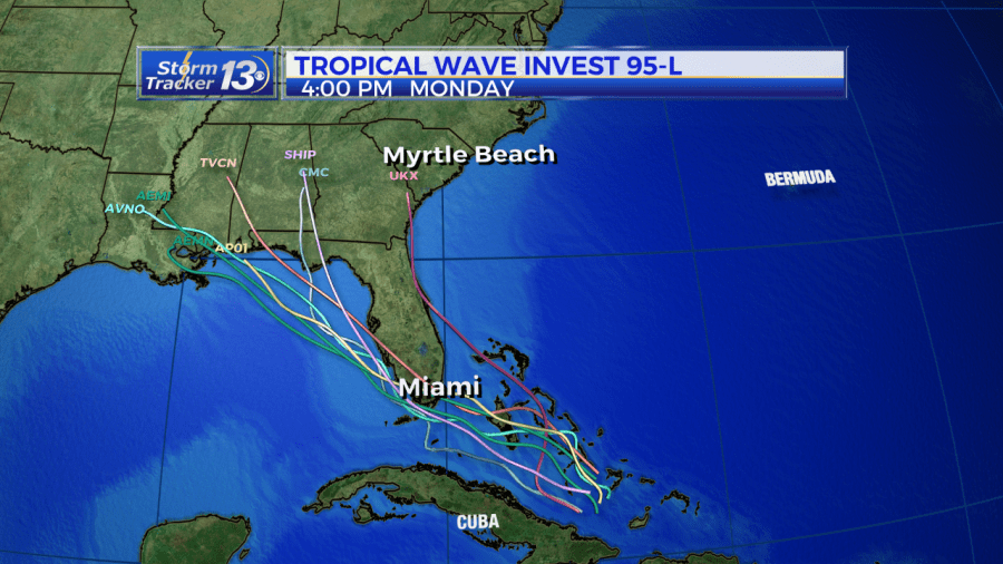
We are currently monitoring three tropical waves that could develop into something more tropical. The first is a wave with shower and thunderstorm activity near Turks and Caicos. The activity here has increased over the past several days. Limited development of this disturbance is expected during the next couple of days as it moves west-northwest.
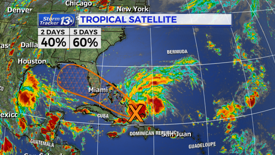
However, environmental conditions could become more conducive for development when the system moves over the Florida Straits and the Gulf of Mexico later this week into the weekend. There is now a 60% chance for tropical development in the next 5 days.
The second tropical wave is invest area 94L located about 900 miles east of the Lesser Antilles. This weak area of low pressure is producing disorganized showers and storms. Some slight development is possible, however upper-level winds are forecast to become unfavorable for any tropical cyclone formation. This area has a 10% for tropical development.
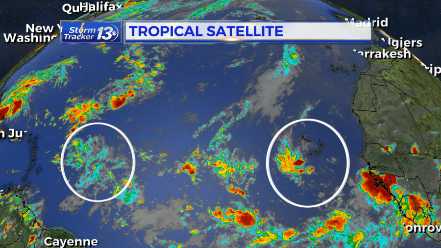
Behind invest area 94L, is a tropical wave coming off the West African coast. This wave is expected to move quickly westward during the next several days. It is possible it could merge with the other tropical wave and have a better chance for tropical development through the next several days into next week. Models are picking up on this one a little more.
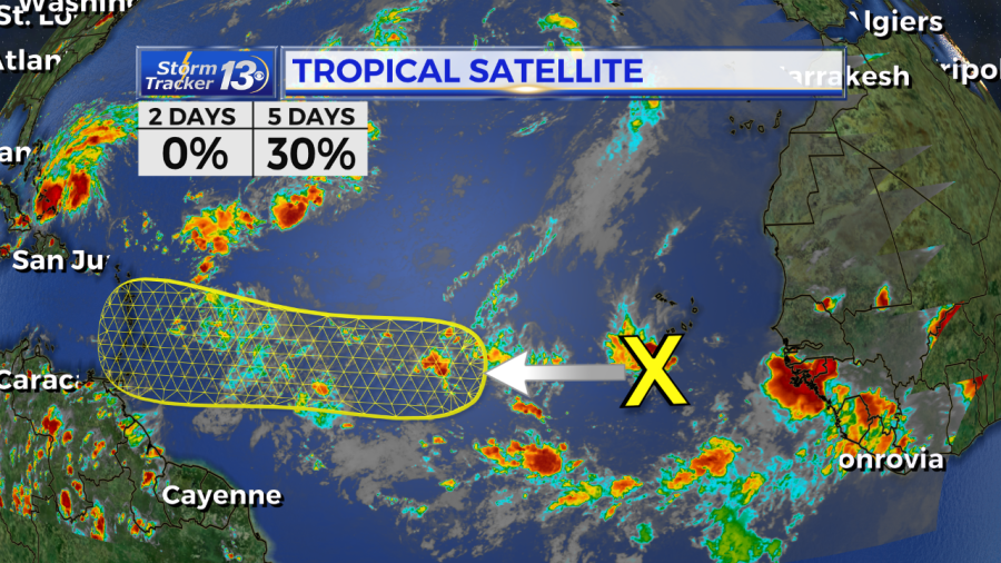
Right now the National Hurricane Center is giving this a 30% chance for tropical development over the next 5 days as it approaches the Lesser Antilles. At this time, there is no threat the Carolinas or the U.S. with this storm, but it is one we will continue to monitor.
PREVIOUS DISCUSSION: We are currently monitoring three tropical waves that could develop into something more tropical.
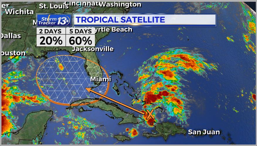
The first is a wave with shower and thunderstorm activity near Turks and Caicos. The activity here has increased over the past several days. limited development of this disturbance is expected during the next couple of days as it moves west-northwest.

However, environmental conditions could become more conducive for development when the system moves over the Florida Straits and the Gulf of Mexico later this week into the weekend. There is now a 60% chance for tropical development in the next 5 days.
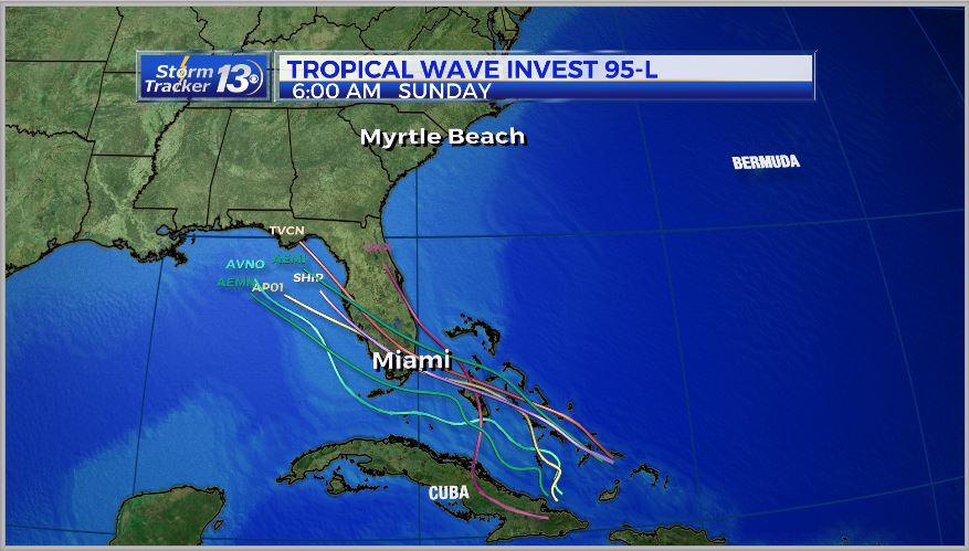
The second tropical wave is invest area 94L located about 900 miles east of the Lesser Antilles. This weak area of low pressure is producing disorganized showers and storms. Some slight development is possible, however upper-level winds are forecast to become unfavorable for any tropical cyclone formation. This area has a 10% for tropical development.
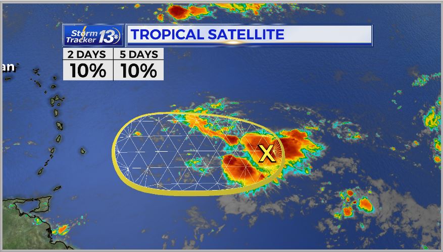
Behind invest area 94L, is a tropical wave coming off the West African coast. This wave is expected to move quickly westward during the next several days. It is possible it could merge with the other tropical wave and have a better chance for tropical development through the next several days into next week. Models are picking up on this one a little more.
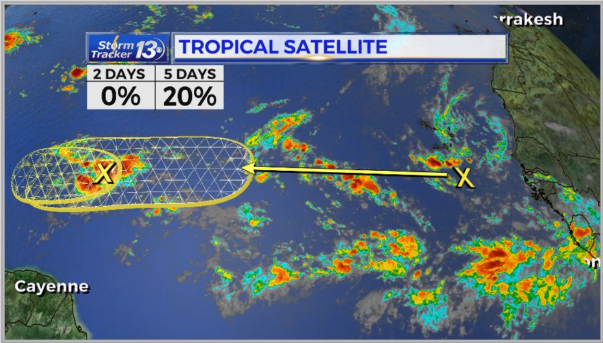
Right now the National Hurricane Center is giving this a 20% chance for tropical development over the next 5 days as it approaches the Lesser Antilles. At this time, there is no threat the Carolinas or the U.S. with this storm, but it is one we will continue to monitor.
