MAY 14TH UPDATE:
Conditions are becoming a little more favorable for the possibility of our first named storm of the 2020 Atlantic Hurricane Season. While we are just 2 weeks away from the official start, it is not uncommon to see systems form this early out. If we do see a tropical system develop this weekend, it would be the 6th consecutive year of early season named storm. If this system develops it would take on the name Arthur and would likely be a sub tropical depression or storm.
WHAT WE ARE WATCHING:
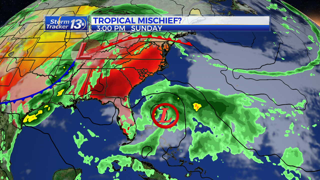
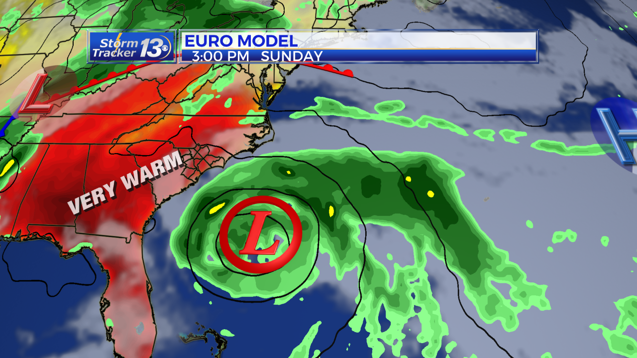
A trough of low pressure is located over the Straits of Florida and is producing a large area of cloudiness and thunderstorms. Environmental conditions are expected to become conducive for development, and this system is likely to become a tropical or subtropical storm by late Friday or Saturday when it is located near the northwestern Bahamas.
The system is then forecast to move generally northeastward over the western Atlantic early next week. The national Hurricane Center is giving this system a high 70% chance for tropical development over the next 48hours and a high 80% chance of development over the next 5 days.
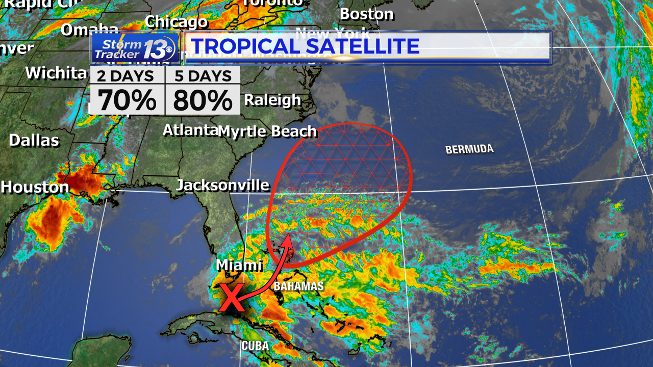
An Air Force Reserve Hurricane Hunter aircraft is scheduled to investigate this system tomorrow, if necessary.
FOR THE CAROLINAS:
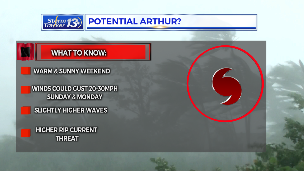
This system is expected to stay well offshore and not have any direct impacts to the Carolinas. As the system develops and moves northeast this weekend, some indirect impacts we would see, would be in the way of slightly higher waves, which surfers would love, and a higher rip current threat that could be a danger to swimmers. Our forecast is calling for mostly sunny skies with highs in the 80s both Saturday and Sunday. A few forecast models are suggesting some wind gust near 20-30mph Sunday and Monday. This would be in part to an approaching cold front along with our system well offshore.
MAY 13TH UPDATE:
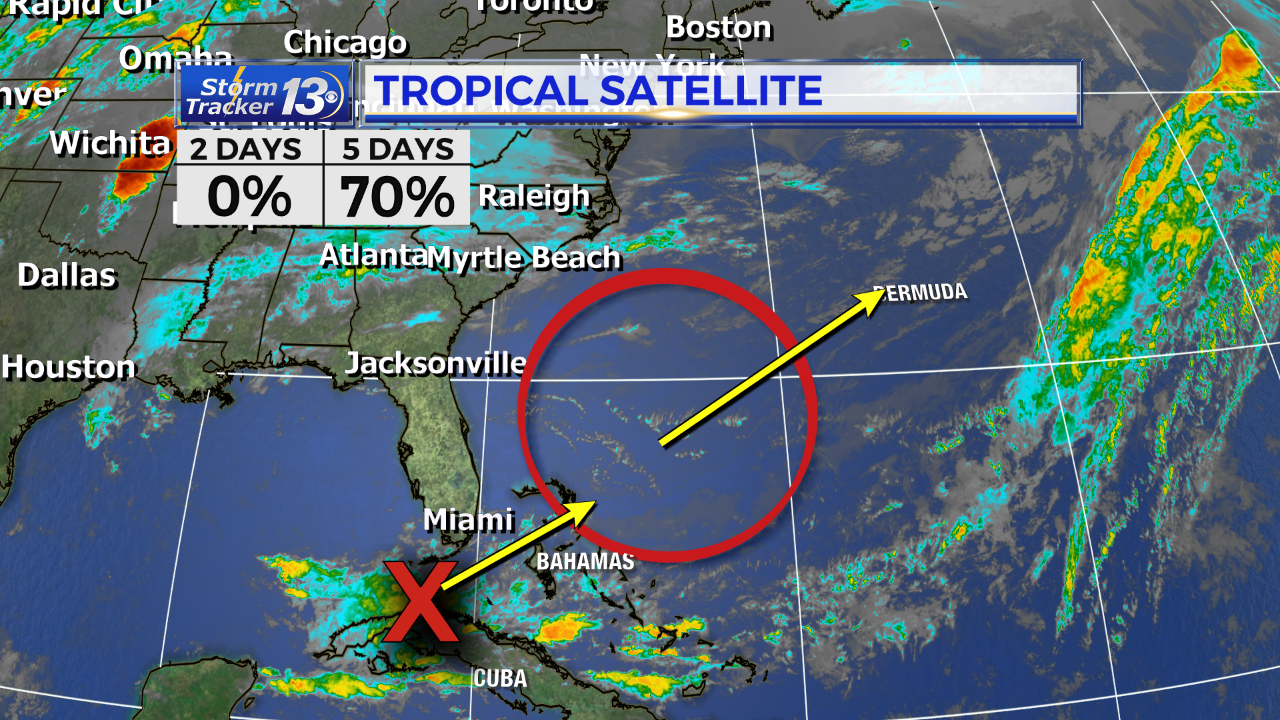
A broad area of low pressure is expected to develop late this week or early this weekend over the southwest Atlantic Ocean near or within a couple of hundred miles north of the Bahamas. Environmental conditions appear conducive for gradual development of this system, and a subtropical depression or storm is likely to form this weekend while it moves northeastward over the western Atlantic.
It has a near zero chance of formation during the next 48 hours and a 70 percent chance during the next five days.
The next Special Tropical Weather Outlook on this system will be issued by NHC at 9 p.m. EDT tonight, or earlier, if necessary.
This system i no threat to the Carolinas with the exception of higher waves and a higher rip current threat this weekend.
Tuesday May 12th Update:
The National Hurricane Center is giving a 50% chance for tropical development for this weekend in an area northeast of the Bahamas.
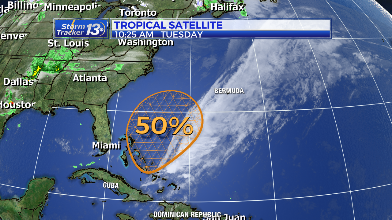
An area of low pressue is expected to develop this weekend and environmental conditions appear to be conducive for this system to acquire some subtropical characteristics through Sunday.
At this time this system appears it would remain a weak system and no threat to the Carolinas.