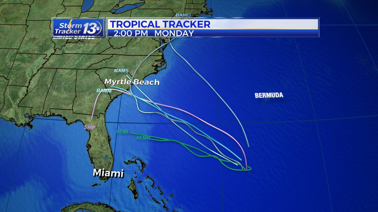
Chances for tropical development are increasing east of the Bahamas. Showers and thunderstorms continue to develop along a front stalled over the Atlantic Ocean. Ocean water temperatures in this area are between 80-85 degrees, which is warm enough for tropical storm development. Several computer models develop and area of low pressure along this front Thursday or Friday. There is a chance that this could develop into a tropical depression or a weak tropical storm.The National Hurricane Center has raised its chance of development to 50%. Yesterday the NHC had the chance at 30%.Regardless of tropical development, this moisture will be moving northwest toward the Southeast coast. This will bring a chance for scattered thunderstorms starting Saturday, and continuing through the weekend and into next week. If a tropical storm would develop, there would be a period of heavier, steadier rain. It is still too early to know exact track or timing of any tropical system.

Hurricane season officially begins next Wednesday, June 1. One of the main areas of tropical development during the months of May and June is off the Southeast coast from Florida through the Carolinas. Oftentimes, when a cold front stalls in this area, it leads to tropical development. This is what we are watching for this week.If a tropical depression or storm does form, it will likely not have enough time over warm water to gather much strength. The main impact from a potential storm will be heavy rain. Winds will be a lower concern.Timing for development will be either Thursday or Friday, with the storm system heading toward the Southeast coast Sunday or Monday. Early computer model forecasts show potential tracks ranging from Florida to North Carolina. Computer models are not very accurate with tropical systems until a storm actually forms… so once it does develop, timing and track forecasts will be more confident.


