MYRTLE BEACH (WBTW) – Tropical Depression Eight has formed off the Carolina Coast about 405 miles southeast of Cape Hatteras, North Carolina.
Maximum sustained winds with the Tropical Depression are 35 mph as of 5 PM Sunday. The storm is moving to the west at 9 mph, and the minimum central pressure is 1009 mb.
This system is forecast to move west/northwest through Tuesday, and will likely strengthen into a Tropical Storm and will be given the name Tropical Storm Hermine.
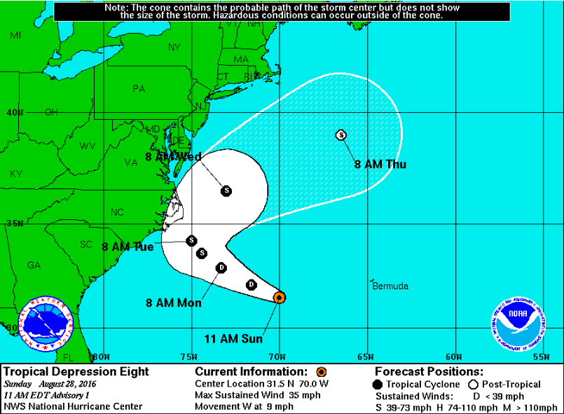
There are no coastal watches or warnings in effect at the moment, but we will have to monitor for the potential that a Tropical Storm Watch may be required for the Outer Banks later today. The storm is expected to make a close brush with the North Carolina coast, but should remain NE of our forecast area.
Nevertheless, showers will increase through mid-week, and an elevated rip current risk is expected through mid-week.


