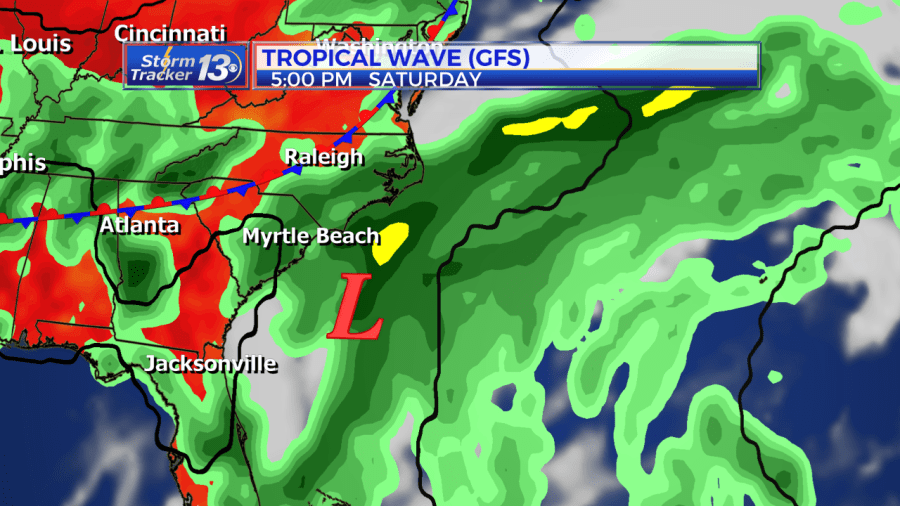
Forecast:Tropical Wave just offshore of the Florida coast today will track north then northeast this weekend. The tropical wave is not expected to develop but it will send a surge of tropical moisture into the Carolinas as it gets closer into the weekend. The wave will stay just offshore of the Carolina coast. It’s closest approach to the Carolinas will occur late tonight through Saturday with widespread showers and storms, some accompanied with tropical downpours.

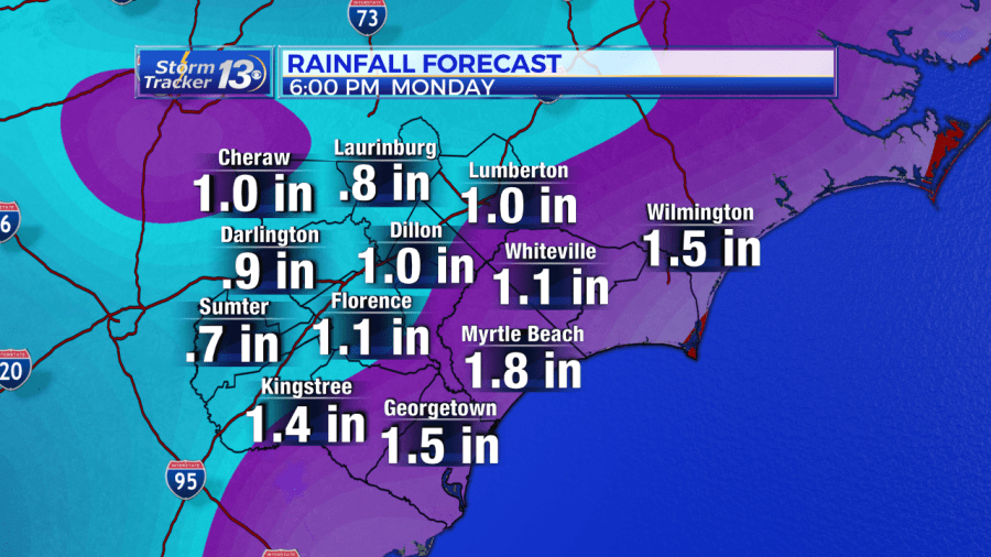
Main Impact: Heavy rainfall, with widespread 1 to 2 inch amounts east of the I-95 Corridor, with lower amounts west of I-95. Localized flooding possible across prone locations especially closer to the coast where the highest rainfall amounts will occur. Where storms move slow and reform over the same area, rain totals could exceed 3+ inches but will be in localized areas. This is where flash flooding could occur this weekend. If you come across a flooded roadway, please “Turn around, don’t drown”

Coastal Impacts: An elevated Rip Current Risk throughout the weekend. Tidal flooding along the immediate coast during high tide cycles each evening and overnight.


