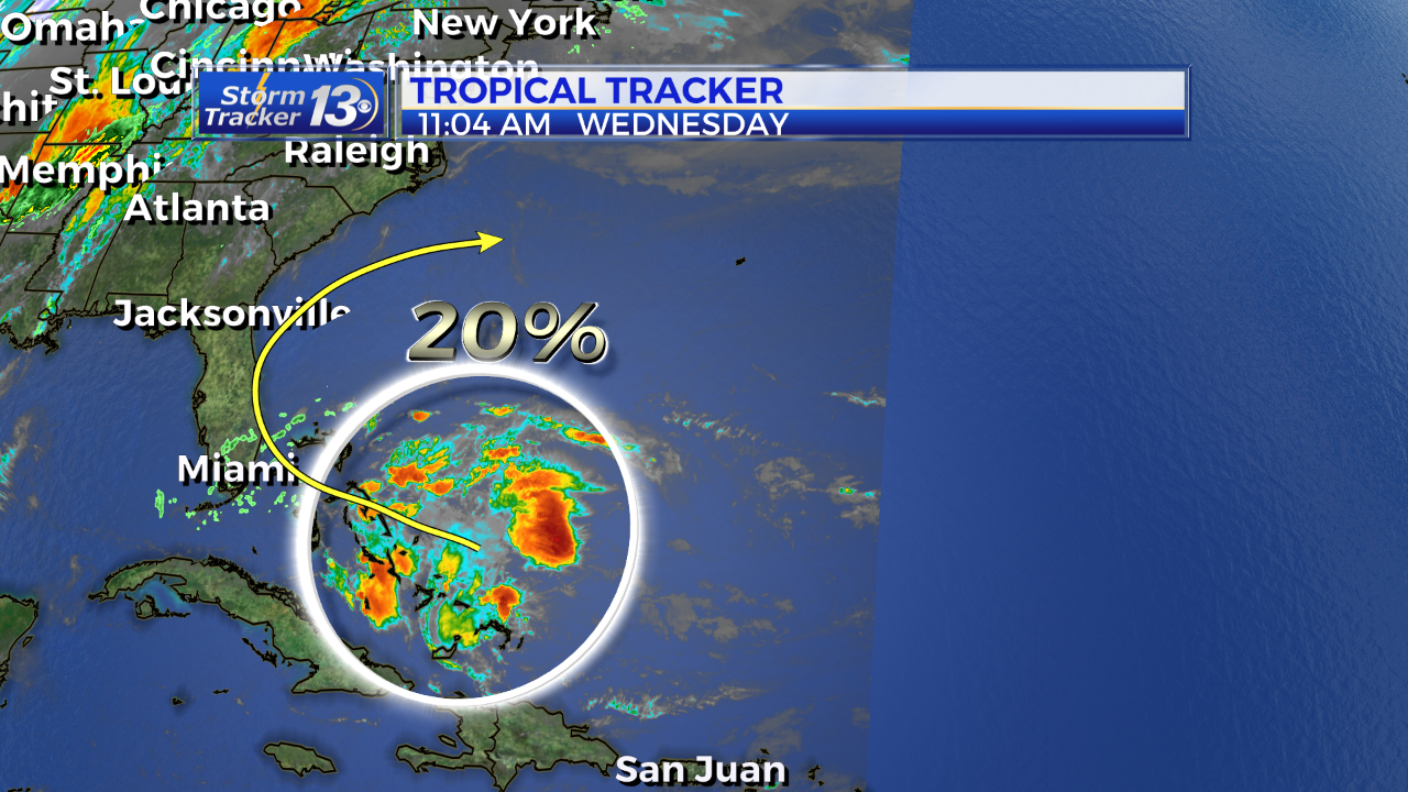
An area of disorganized shower and thunderstorm activity near the Bahamas will be our next weather maker. This is NOT expected to become anything tropical but will bring tropical moisture as it moves north. The National Hurricane Center is giving this a 0% chance of development over the next 2 days and only a low chance (20%) of developing over the next 5 days.

The tropical wave will move toward the Florida peninsula through Thursday before moving north towards the Carolinas by Friday and Saturday. Scattered showers and thunderstorms are in the forecast Friday and some of Saturday as a result of this system in our vicinity. It is expected to stay offshore as a cold front moves in and pushes it away by Sunday.


